
Saudi Arabia to Merge Navigation Apps Into Single KSA Map Platform
Saudi Arabia is consolidating its local navigation apps into a single national platform called KSA Map. Announced on December 30, 2025, the initiative merges government mapping services to eliminate duplication, improve spending efficiency, and offer a domestic alternative to foreign navigation products.
KSA Map will combine the Saudi navigational maps app and Balady Plus, delivering a navigation experience that authorities say matches global standards.
What is the KSA Map project?
The KSA Map project merges government navigation services under one entity. The General Authority for Survey and Geospatial Information and the National Housing Services Company announced the plan on December 30, 2025.
The primary goal is to unify existing efforts and coordinate between government agencies, their companies, and programs developing navigation map applications. The initiative also aims to improve spending efficiency, secure national sovereignty over geospatial data and technology, and create a local competitor or alternative to foreign products in the Saudi market (Al Madinah newspaper).
How do you use the Balady app for navigation and municipal services?
Balady combines navigation with municipal services. It offers smart maps with a three-dimensional interface that alerts users to speed limits and speed bumps, along with indoor navigation for shopping malls and facilities.
Beyond navigation, the app provides municipal services such as construction license inquiries, Ikram services, a "photograph and send" feature, and volunteering opportunities. Artificial intelligence supports service delivery and processing stages, according to the Balady platform.
To download and use the app, follow these steps:
- Open the Apple App Store or Google Play Store depending on your device.
- Search for "Balady" and download the app released by the Ministry of Municipalities and Housing.
- Update your iOS or Android operating system to the latest version.
- Ensure your device has enough storage space for the download.
- Enable location services for the app in your device settings to activate tracking and navigation.
- Open the app and select Arabic or English in the settings under the profile tab.
- Tap the profile tab and log in using single sign-on credentials.
The service targets individuals, is delivered instantly, and is available exclusively online through the Balady portal and mobile app.
How do local and global navigation apps compare in Saudi Arabia?
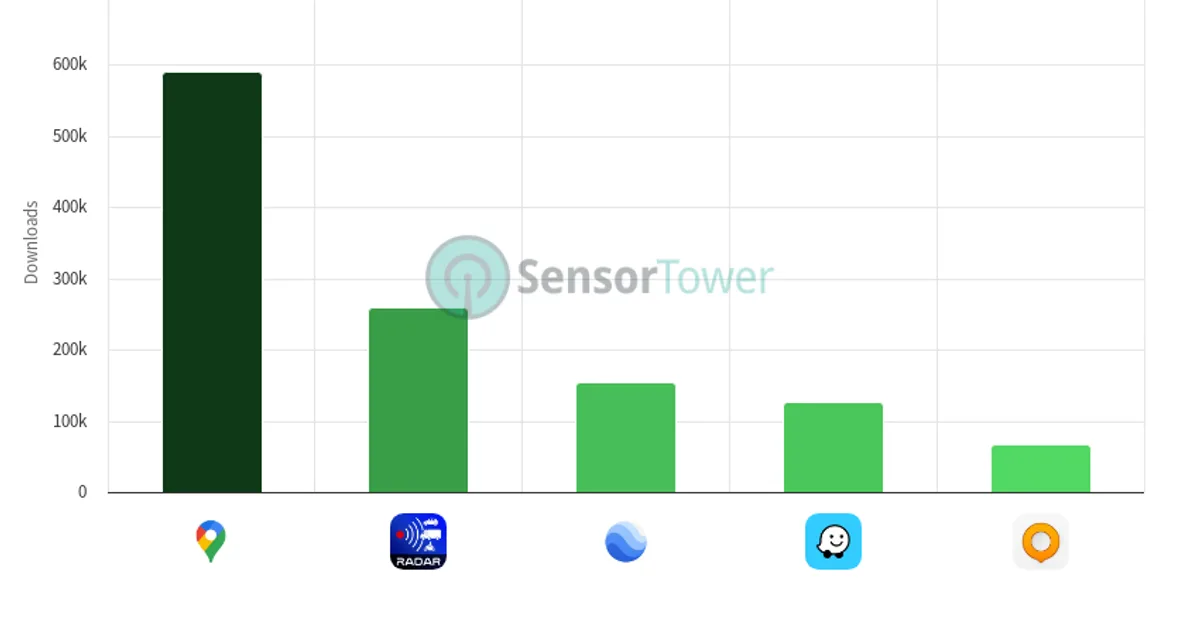
The KSA Map announcement reshapes competition in the Saudi navigation market. Local applications will merge into a single entity, while international apps continue operating independently.
| App | Responsible entity | Key features | Status |
|---|---|---|---|
| KSA Map | General Authority for Survey and Geospatial Information and National Housing Services Company | Unified national entity, data sovereignty | Strategic direction announced on December 30, 2025 |
| Balady | Ministry of Municipalities and Housing | Three-dimensional maps, speed and bump alerts, indoor navigation, municipal services | Available for download |
| Global apps | International technology companies | General navigation | Foreign products targeted for local replacement |
Through KSA Map, government agencies aim to deliver a national navigation application matching global best practices, providing a local competitor or alternative to foreign products in the Saudi market (Al Madinah newspaper).
Why is Saudi Arabia unifying its map and navigation apps?
The consolidation ends duplication among local applications that previously operated separately. Merging the navigational maps app run by the General Authority for Survey and Geospatial Information with Balady Plus, managed by the National Housing Services Company, is designed to improve spending efficiency.
The move also ties directly to national sovereignty over data and geospatial technology. The Kingdom intends to manage its spatial data through a single national platform rather than dispersing it across multiple government applications.
When was the KSA Map merger announced?
The strategic direction for the merger was announced on December 30, 2025. The General Authority for Survey and Geospatial Information and the National Housing Services Company made the announcement in Riyadh, and the Saudi Press Agency (SPA) published it, as reported by Al Madinah newspaper.
How does the tech sector support local navigation development?
Application infrastructure development aligns with broader efforts to support technology companies in the Kingdom. At LEAP 2026, the Saudi Abdul Latif Jameel Community Foundation signed a cooperation agreement with the National Program for Developing the Information Technology Sector to empower tech firms and entrepreneurs.
The agreement covers knowledge exchange, mentoring, project support, and promotion of assistance programs such as the prototype development support product, which offers financial grants and services to entrepreneurs. Mohammed Abdel Ghaffar, executive director of initiatives at the foundation, said coordination between government entities and the private sector is essential to strengthening the entrepreneurship and innovation ecosystem in line with Vision 2030 goals (Al Eqtisadiah newspaper).
Key figures
- KSA Map announcement date: December 30, 2025 (Al Madinah newspaper)
- Merged services: Saudi navigational maps app and Balady Plus (Al Madinah newspaper)
- Balady target audience: Individuals (Balady platform)
- Balady service duration: Instant (Balady platform)
- Balady service launch date: August 6, 2024 (Balady platform)
- Tech event for support agreements: LEAP 2026 (Al Eqtisadiah newspaper)
What to watch next
Watch for the official launch of KSA Map following the December 2025 strategic announcement to see how it affects daily navigation. Until then, the Balady app remains available for download, offering three-dimensional maps, speed alerts, and integrated municipal services. Initiatives from the National Program for Developing the Information Technology Sector may also produce new navigation solutions from Saudi startups.